Steven Russell 42.8500° N / 78.7547° W
Enterprise GIS · ECM Systems

Steven Russell

GISP, EIT — building and administering enterprise geospatial and content systems out of Buffalo, New York.

About

The short version.

I'm a civil engineer turned GIS practitioner with deep experience building enterprise geospatial programs from the ground up — geodatabases, web mapping, mobile field collection, and the everyday plumbing that keeps spatial data trustworthy. Pairing an engineering background with a graduate degree in geography means I tend to think about GIS as infrastructure: something other people rely on to do their actual work.

These days I administer enterprise GIS and OnBase ECM systems for Erie County, teach Intro to GIS at Erie Community College, and serve as Awards Committee Chair for the New York State GIS Association. The combination of engineering, GIS, and enterprise content management is a rare one — and one I've leaned into throughout my career.

Outside of work, I'm usually collecting vinyl records, watching F1 and the Guardians/Bills/Sabres/Cavs and Bandits, or heading out to the country with family (and two dogs).

Steven Russell, GISP, EIT
Credentials

The certified bits.

Certification
GISP
GIS Professional · #91262
Engineering
EIT
Engineer in Training · NCEES
Platform
OnBase Certified
System Administrator · Hyland
Education
MA, Geography / GIS
University at Buffalo
Education
BS, Civil Engineering
University at Buffalo
Research
PhD Coursework
Remote sensing · impervious surface classification
Currently

Where the time goes.

Enterprise GIS & ECM Systems Administrator
Erie County Department of Social Services · Buffalo, NY
Administer enterprise GIS and OnBase ECM platforms supporting county-wide operations. Forms design, workflow automation, geodatabase administration, SharePoint integration, and the steady work of keeping data infrastructure trustworthy.
Adjunct Faculty — Introduction to GIS
Erie Community College · Williamsville, NY
Teach GP150 Intro to GIS, covering ArcGIS Pro, spatial analysis, and data modeling. Developed the full GIS Certificate Program curriculum when it was active.
Awards Committee Chair
New York State GIS Association (NYSGISA)
Lead the statewide awards program recognizing excellence in GIS practice across New York's public, private, and academic sectors.
Selected Work

A few things I've built.

Most of my work lives behind government firewalls, so here are the projects I can talk about. The ArcPy automation behind a couple of them is up on GitHub.
Building the systems behind a department's work
Erie County Dept. of Social Services · 2018-present
At DSS my building work is in content and process, not maps. I design and administer the OnBase ECM platform — building Unity and image forms, HTML forms with custom JavaScript, plus automated routing and approval workflows — and as the department's SharePoint administrator I built the site from scratch, wiring it with Power Automate flows that email the right people the moment an item changes. The same build-from-nothing instinct as the GIS work, pointed at enterprise content.
OnBase: Unity / image / HTML+JS formsSharePoint admin, built from scratchPower Automate workflowsprocess design
Rebuilding what the last GIS person took with them
NCRR · 2023-2025
Administered NCRR's legacy Geocortex web GIS and built in ArcGIS Experience Builder. When the previous person's coordinate script left with him, I rebuilt it from scratch — a straightforward Python tool that walks the vertices of the corridor centerline and pulls northings, eastings, and bearings into points along the line.
Python coordinate extractionGeocortex administrationArcGIS Experience Builder
View the code on GitHub ->
Building a county's sewer GIS from scratch
Erie County Sewerage
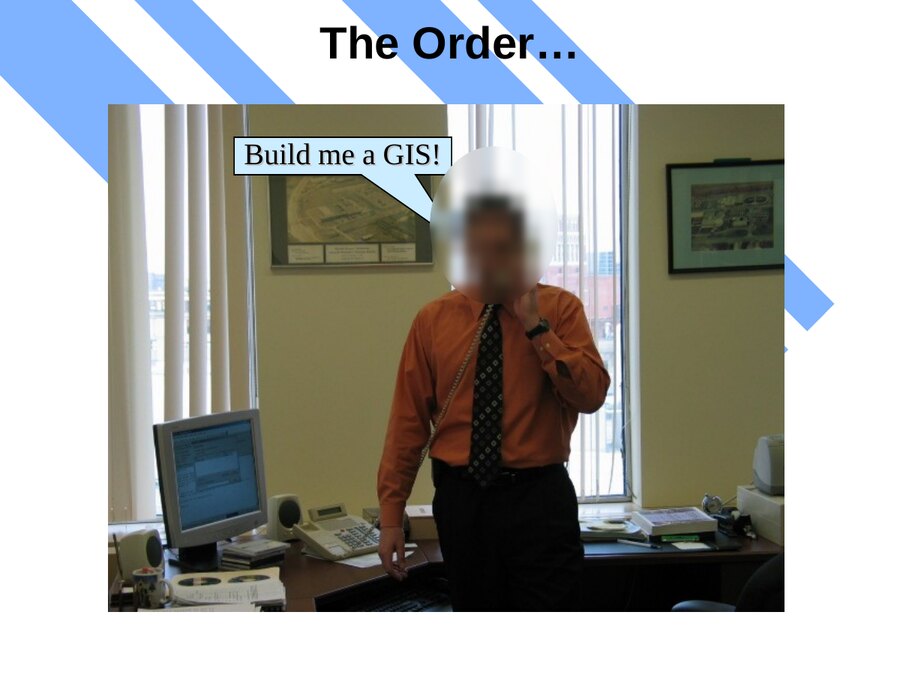
It started with my boss saying "build me a GIS," one copy of ArcView 3.2a, and no budget to speak of. I grew it into a versioned enterprise geodatabase on SQL Server that became the division's system of record — roughly 1,000 miles of line and 24,000+ structures, captured by GPS/RTK and kept trustworthy with real QA/QC.
11,000+ as-builts migrated50,000+ assets surveyed~75% of the networkArcSDE / SQL Server
Boss on the phone saying Build me a GIS
"Build me a GIS" - the order that started the program
View the code on GitHub ->
The web GIS that won people over
Erie County Sewerage
I drove the county's web mapping from its early days through ArcGIS Server and a Geocortex site I carried from Silverlight to HTML5 - plus field apps in Web AppBuilder and Collector. Wiring live 811 dig tickets straight onto the map is what finally turned the skeptics into daily users.
ArcGIS Server to GeocortexWeb AppBuilder + Collectorlive 811 ticket feed
Automating the 811 one-call program
Erie County Sewerage
I replaced a paper dig-ticket process with an automated Dig Smart and infraMAP workflow running on rugged field hardware. It took daily staffing from 11 people down to 4, pushed ticket accountability to 100%, and ended the late-ticket fines for good.
~23,000 tickets / year11 to 4 staff100% accountability2015 NYSGISA finalist
Mapping impervious surface from LiDAR and imagery
Graduate research
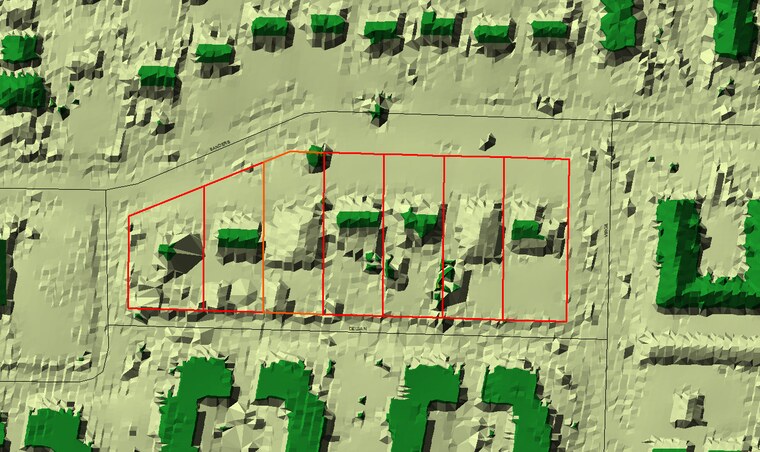
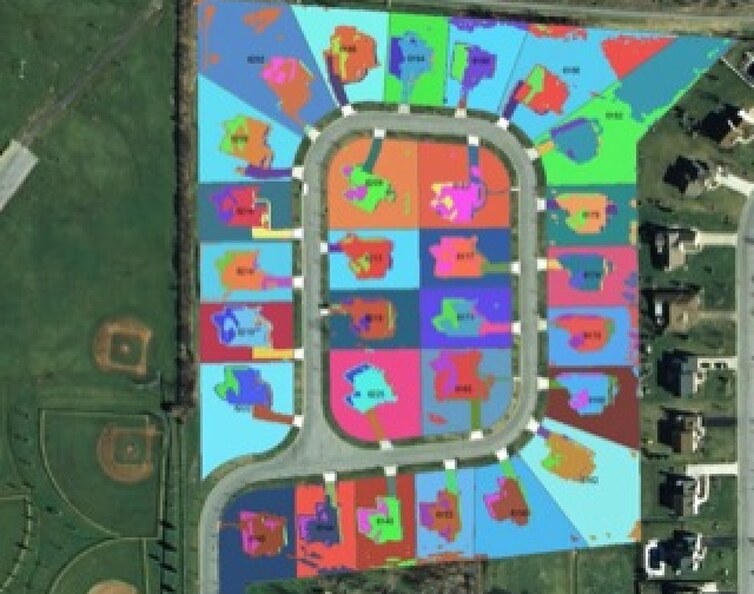
I fused LiDAR returns with multispectral imagery to estimate impervious surface, comparing supervised classifiers — maximum likelihood, neural network, and SVM — in ENVI, and pulling building footprints out of the point cloud. The early version of the GIS-meets-AI work I'm still chasing today.
LiDAR + imagery fusionENVIMLC / NN / SVM
Spectral land-cover classification of a subdivision in Lancaster, NY
Spectral classification, Lancaster NY
LiDAR surface model showing buildings and tree canopy in relief
LiDAR surface model - buildings and canopy in relief
Teaching the next GIS people
Erie Community College · University at Buffalo · RIT
I teach Intro to GIS at ECC and built the full GIS Certificate curriculum back when it ran, with earlier stints at UB and a graduate course at RIT in 2023. Explaining this work to people who have never seen it is how I stay honest about what GIS can and cannot do.
GP150 Intro to GISbuilt the ECC certificateArcGIS Pro
Selected Talks

Talks I've given.

Over the years I've taken this work to the podium - from the local user group up to national conferences.

Building a county enterprise GIS for sanitary and storm sewers
Esri International User Conference
Modernizing a county's public web GIS
NEARC - Northeast Arc Users Group
Impervious-surface mapping from LiDAR and multispectral imagery
Association of American Geographers (AAG) Annual Meeting
GIS inside an Emergency Operations Center
University at Buffalo - IGERT
Methods for storm sewer mapping with RTK and mobile GIS
WNY Stormwater Conference
Managing a wastewater utility geodatabase
Esri Water & Wastewater GIS Conference
GIS and GPS municipal case study: Village of Hamburg
GBEC Conference
Résumé

The full picture.

A PDF with the complete work history, software stack, and project highlights — handy if you're in a hiring conversation or just curious.

Download Résumé
Contact

Get in touch.

X/Twitter
@stevenrusselljr
GitHub
srusselljr
Location
Buffalo, NY